Ecological intelligence platform
Insight
Customisation
Compliance
The Ecoda intelligence ecosystem
Ecocene's Ecoda platform transforms complex ecological information into actionable intelligence and ensures regulatory compliance through streamlined data collection, management and reporting solutions.
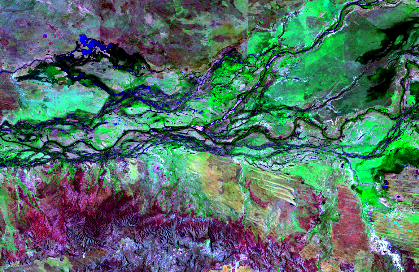


Remote Sensing Data
Earth observation intelligence powered by Ecoda.
Remote Sensing Metrics
A comprehensive suite of analytics and metrics tailored to your specific project objectives and compliance requirements.
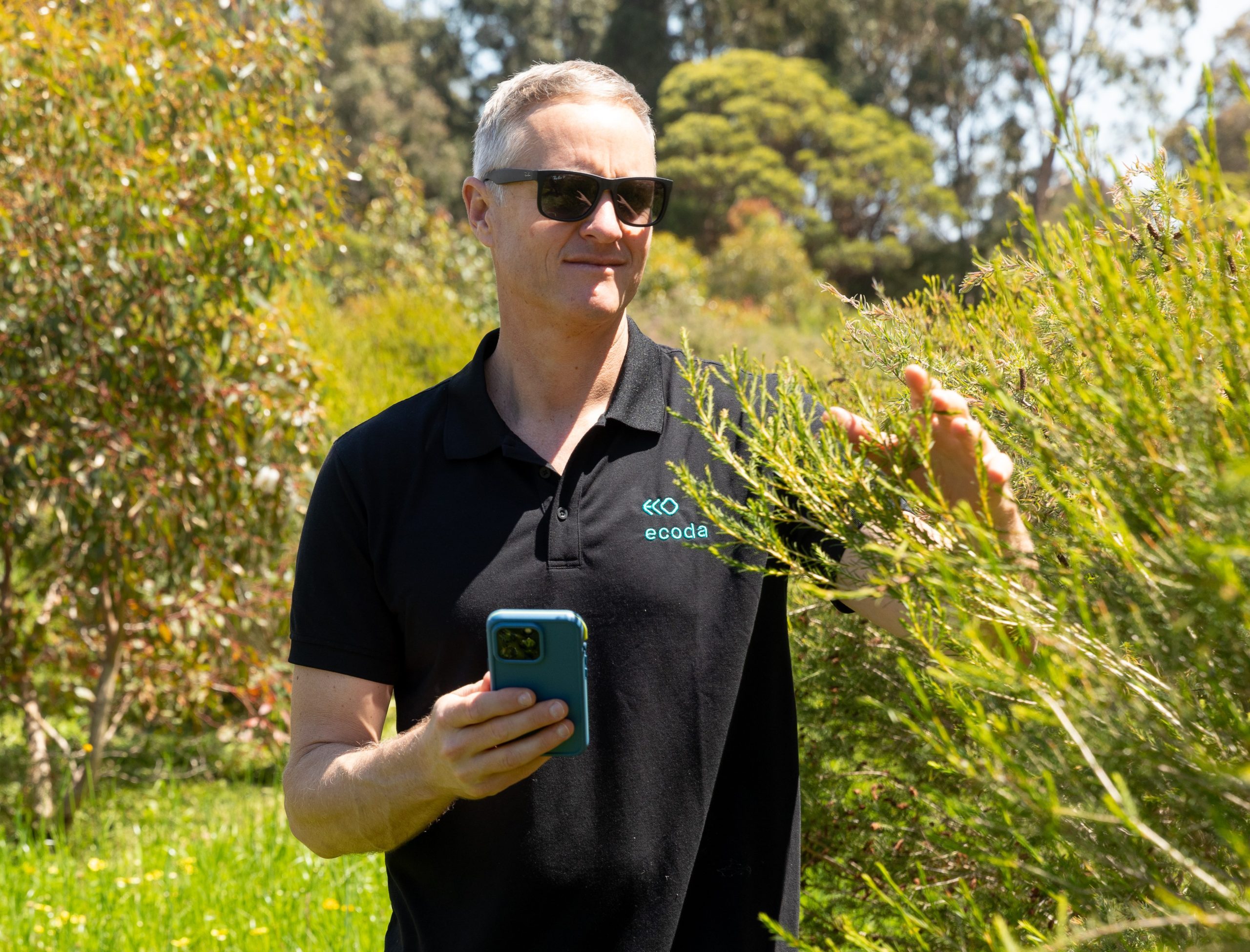
Ecoda Scout
Our configurable field application that standardises data collection and seamlessly integrates with the Ecoda platform.
The Ecoda platform
Transform complex ecological data into actionable insights through our intuitive analytics interface
Built for organisations of all sizes, Ecoda seamlessly integrates information from diverse sources—UAVs, satellites, manned aircraft, remote sensors, and our mobile field application—into a unified intelligence ecosystem.
By putting powerful analytics and comprehensive environmental data at your fingertips, Ecoda helps you minimise ecological impacts while maximising project outcomes. Leveraging custom AI models and a configurable architecture, Ecoda delivers site-specific metrics that streamline compliance reporting while enhancing management outcomes through intelligent decision support.
The Ecoda advantage
Intelligent decision support
Simplified compliance
Expert implementation

Flexible and adaptable
We offer tailored subscription packages designed to match your specific operational requirements, ranging from self-service platforms to fully-supported solutions. Our ecosystem includes Ecoda-ready hardware options include drone and PPK equipment available for hire, on-site training, and complete equipment-with-operator services — all configured to integrate seamlessly with your existing workflows.
Ecoda in action
Ecoda centralises your ecological data and transforms it into clear visualisations and powerful analytics that enhance decision-making and drive measurable improvements in biodiversity and ecosystem restoration outcomes.

Trusted by
FAQs
Explore our FAQs for key insights into Ecoda and our sustainable solutions.
General
Ecoda, the platform, is a data visualisation and analytics tool built on a web application server utilising the latest GIS technology. The platform is customised for delivering insights from remotely sensed and on-ground environmental data in combination. Users interact and visualise their data via an easy-to-use dashboard interface. Fundamental design elements of the Ecoda platform are simplicity and accessibility for users to interact with data and the analytical tools that generate the insights that underpin good management decisions. Ecoda can be used as an operations hub for monitoring and managing environmental assets that fall under the responsibilities or interests of your organisation.
Ecoda, the service, is the platform plus the team that created, built and maintain it, and who provide personalised on-going support to users. This support includes acquisition of data, delivery of these data through Ecoda and extends to subject matter expertise across ecology, rehabilitation, and remote sensing.
The Ecoda workflow is modular, enabling customisation to your project each step of the way:
Capture your own data using your own drone, or select satellite, aerial and drone data provided by our partner network.
Convert your data into insights by electing from our metrics library, or work with us to customise outputs to suit your project needs.
Enhance your understanding through the integration of field data, collected with our customisable mobile app Ecoda Scout.
Then use the Ecoda platform to visualise and analyse your results.
Ecoda provides environmental metrics produced from remote sensing and on-ground data at the landscape scale. Remote sensing metrics are an objective and repeatable way of measuring environmental variables across a landscape. Metrics can be viewed as overlays on an interactive map and in a quantitative metrics report that can be exported for sharing and inclusion on reports.
We have customers across sectors including Biodiversity and Ecosystem Restoration, Mining and Energy, Government, Regenerative Agriculture, and Infrastructure and Development. Our customers are located across Australia in Queensland, Western Australia, Victoria and South Australia; and internationally in South America and Papua New Guinea.
Ecoda is being used by environmental managers and consultants, rehabilitation and biodiversity specialists, operations managers, farmers and community groups. Our customers include Greening Australia, Main Roads WA, Roy Hill, Anglo American, Westgold, Barto Gold and Northern Star Resources.
Ecoda gives you access to all your data in one place, helping you plan activities and make better environmental management decisions.
You can use multiple types of data, many times and for different purposes.
Ecoda's visualisation and analytics tools simplify complex remote sensing data over your entire project, helping you understand how your restoration is progressing against criteria and objectives.
Our field data collection app, Scout, allows you to customise field activities and collect standardised and consistent data that integrates with remote sensing data on the Ecoda platform.
At its core Ecoda has a team of highly experienced environmental practitioners and innovators, with decades of collective technical knowledge in biodiversity and ecosystem restoration, environmental monitoring, mine closure, remote sensing analysis and data science. Ecoda has been developed by, and for, all types of environmental practitioners; it is intuitive to use and makes it easy to interpret results from complex remote sensing and data analyses.
We offer a personalised and responsive customer service, and support from experts as needed. We will involve and support you through the entire process of project scoping, understanding data requirements, structuring of your workspace on the Ecoda platform and generally ensuring that everything we do is to achieve the best outputs that meet your requirements, make sense to your team, and can be used to inform your decisions.
While Ecoda is built on a GIS, it is much easier to interact and query than typical GIS applications - no technical knowledge or skills in GIS are needed. Additionally, the Ecoda platform has easy-to-use analytical and reporting functionality specific to environmental applications.
Ecoda deals with data in open-source formats (KML and CSV); so data can be downloaded to your existing GIS system, or you can upload files yourself to Ecoda.
Ecoda is built on a modular framework so that it is adaptable to any type of organisation or biodiversity restoration project. The features and tools within Ecoda have been developed and improved over time with input from partners and clients from a range of sectors. Our team will work with you to customise the structure of your project within Ecoda and select the right metrics to provide the insights you need.
Yes, Ecoda has a flexible framework that can be used to suit many different project sizes, shapes and objectives. We have projects that comprise a single small rehabilitation site, through to multiple mine operations and rial corridors spanning hundreds of kilometres in length.
Our team will work with you to determine the best way to structure your projects within your workspace to ensure optimal responsiveness of Ecoda regardless of the project size or amount of data, and to provide the outputs you require.
We understand that environmental management is adaptive and restoration is progressive, so we ensure that your project structure allows for future expansion or changes, while retaining data continuity.
You can view our most frequently requested metrics in our library. We are always updating our metrics suite, so if you don't find what you need, have a chat to us.
In the project scoping stage we will request information about your project objectives and relevant restoration criteria, which will help us advise on the most appropriate metrics.
Within Australia we have been engaging with all levels of government on the use of remote sensing data as a tool to monitor and manage ecosystems, including mine rehabilitation performance.
Remote sensing is now routine in environmental monitoring and commonly included in mine closure plans and Ecoda data is used to report on performance against agreed completion criteria throughout Australia.
We designed Ecoda to be intuitive for all users, and many of our users jump straight in and hit the ground running. An Ecoda subscription includes personalised onboarding, training and ongoing support for your team. We can also provide customised workshop training and have an interactive User Manual available within Ecoda.
We will request information about your project size, layout and objectives, relevant monitoring criteria, your existing data and future data capture programs.
Features
Ecoda in-platform tools enable the user to easily visualise, aggregate and compare data that have been produced by complex remote sensing analysis. The map interface allows layering of metrics with multiple data overlays and visual comparison between data captures, providing a more wholistic understanding of ecosystem conditions and management actions that may be required.
The Metrics Analysis report provides charts and tables for chosen metrics. Users can compare sites such as rehabilitation areas across years, and with other sites such as analogues or controls.
The Analytics tool displays an aggregations of data across the entire project operations for a selected metric. This is a tool that enables the user to rapidly visualise large amounts of data at scale to determine which rehabilitation areas are performing or need additional management. Filters can be applied to easily determine which areas have achieved relevant completion criteria.
Ecoda's tools allow you to produce metrics reports for your areas of interest. The metrics report includes a summary of data within tables and charts, and provides an opportunity to compare sites across times and space, or with analogues (reference areas).
Ecoda also has an Analytics tool that displays a visual amalgamation of all results across your entire project area. This allows you to rapidly identify restoration areas that are performing poorly, or see which of. your sites has achieved restoration criteria.
All report data can be exported to further statistical analysis or for inclusion in monitoring and compliance reports.
We can also produce management report cards or more traditional reports, on request.
Access
Ecoda can be installed on premises or hosted in the cloud.
All Ecoda workspaces are hosted on separate servers which can be accesses only by personnel within your organisation. Additionally, we can provide guest access to limited datasets for third parties such as consultants or stakeholders.
Cloud-based access is enabled via a secure login feature, with a web link that can be shared amongst your organisation, restricted by Domain Name System (DNS) filtering, if required, and readily viewed through common web browsers, such as Chrome and Firefox. Ecoda maintains a continuous backup program for all hosted data.
An Ecoda subscription includes access for unlimited users within your organisation, and guest access to limited datasets for third parties such as consultants or stakeholders.
System upgrades and maintenance are undertaken outside regular business hours to minimise downtime. We will advise you in advance if an upgrade is require to ensure that we avoid any critical access periods. The need for repair is rare and issues are resolved quickly.
We offer personalised customers service and support. Get in touch with us today by:
- Calling (08) 9421 9600 during office hours
- Emailing ecoda@ecocene.com
Once you're on board with us, we have more avenues for phone and email support, plus you can report any issues through the Ecoda platform at any time.
The cost varies based on the size and configuration of your project, and your requirements for data acquisition and analysis. There are two pricing components:
- Subscription: A base annual subscription for access to Ecoda and our services
- Data on demand:
- Data acquisition
- Data analysis - largely calculated using an area by metric rate, but also consider type and complexity of project area, and reporting requirements
Costs are variable so it's best to discuss your project specifics with us and we can give you an indication of pricing.
An Ecoda annual subscription includes:
- Access to experts in remote sending, data analytics, environmental restoration, scientific monitoring design and mine closure
- Onboarding, training and ongoing technical support for Ecoda users
- Server and workspace set up and maintenance
- Data hosting/storage
- Access to analytics and reporting tools
- Personalised customer service
- Contract establishment and maintenance
Submit an online enquiry