Advanced data acquisition for ecological intelligence
We source, process and analyse high-quality remote sensing data to support robust ecological assessments and monitoring programs. Our expertise spans multispectral and hyperspectral imagery, LiDAR and SAR technologies across terrestrial and marine ecosystems. Through partnerships with industry-leading providers, we deliver tailored remote sensing solutions via UAV, aerial and satellite platforms, ensuring optimal data for every scale and application.
Your advantages
Customised multi-scale solutions
On-demand or archived data
Expert analysis and support
Satellite imagery acquisition partnerships

VANTOR: Premium satellite intelligence
Ecocene partners with Vantor (formerly Maxar) to deliver industry-leading satellite imagery. Through this collaboration, our clients gain access to Vantor’s unparalleled constellation of high-resolution satellites, including their cutting-edge Legion fleet, providing 30 cm resolution imagery with exceptional clarity and accuracy. The WorldView, GeoEye, and Legion satellites offer multispectral bands capturing visible to near-infrared wavelengths (400-1040 nm) with daily revisit capabilities across 1.5 million sq km per day. Vantor’s virtual constellation provides high-revisit electro-optical imagery and ultra high-resolution synthetic aperture radar (SAR) imagery, through their Satellogic and Umbra partners respectively. This partnership enables us to offer comprehensive coverage for even the most remote project locations, supporting data-driven environmental management with timely, detailed earth observation that powers everything from vegetation analysis to habitat mapping and change detection.
VANTOR GEOSPATIAL PLATFORM PRO (MGP Pro)
Ecocene has partnered with Vantor (formerly Maxar) to provide clients with streamlined access to The Vantor Hub, an enterprise-grade geospatial platform offering unmatched capabilities for environmental management. This collaboration enables on-demand access to Vantor’s vast imagery archive, featuring 125 petabytes of 30 cm high-resolution satellite data and over 6 billion km² of global coverage. Vantor Hub’s powerful cloud-based interface delivers advanced analysis tools, allowing users to rapidly search, discover and analyse Earth observation data without specialised software or hardware requirements. With regular updates, automated change detection, and seamless integration with Ecocene’s ecological solutions, this platform provides the foundation for data-driven environmental monitoring, biodiversity assessment, and natural capital measurement across even the most remote project locations.
PIXXEL: Hyperspectral earth imaging
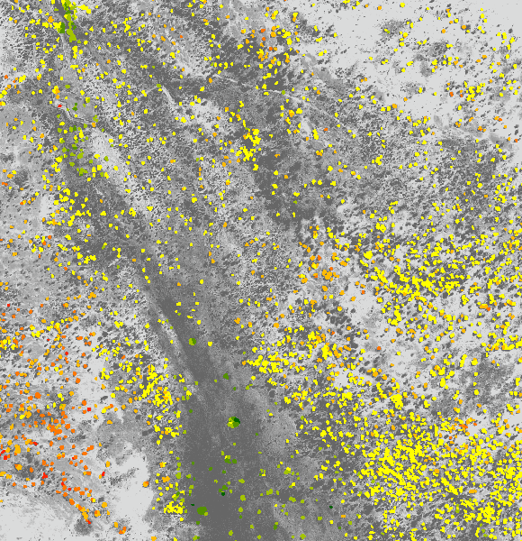
Ecocene’s partnership with PIXXEL delivers next-generation hyperspectral satellite imagery for advanced ecological analysis. This collaboration gives our clients access to PIXXEL’s revolutionary constellation of hyperspectral satellites, capturing hundreds of spectral bands across visible to shortwave infrared (400-2500nm) at 5m resolution. These satellites detect subtle spectral signatures invisible to conventional sensors, enabling precise identification of vegetation species, stress conditions, and biochemical properties. With revisit capabilities of 24-48 hours and intelligent on-board processing, PIXXEL imagery provides Ecocene clients with unprecedented insights for early detection of environmental changes, detailed vegetation health monitoring, and sophisticated ecosystem analysis.
EOMAP: Advanced marine intelligence
Ecocene’s collaboration with EOMAP provides clients with world-class satellite-derived marine data and analytics. This partnership leverages EOMAP’s proprietary physics-based processing technology to deliver high-precision bathymetry mapping (to 30m depth), water quality monitoring, and benthic habitat classification across coastal and marine environments. Their satellite-derived solutions offer 2m-10m resolution data even in turbid or remote waters where traditional survey methods are impractical. By integrating EOMAP’s specialised marine analytics with our ecological expertise, Ecocene delivers comprehensive monitoring and assessment capabilities for seagrass meadows, coral reefs, and other critical marine ecosystems—helping clients make informed decisions about coastal management, marine conservation, and environmental compliance.
SENTINEL: Open access earth observation
Ecocene integrates data from the European Space Agency’s Sentinel satellite constellation to deliver cost-effective environmental monitoring solutions. This collaboration gives our clients access to Sentinel’s comprehensive suite of sensors, including Sentinel-2’s multispectral imaging (10-60m resolution with 13 spectral bands) and Sentinel-1’s C-band SAR capabilities that can penetrate cloud cover and darkness. With a 5-day revisit cycle and global coverage, these satellites provide consistent, long-term data streams ideal for tracking landscape changes, vegetation dynamics, and environmental trends. By processing and enhancing this publicly available satellite data through our advanced platforms, Ecocene transforms Sentinel imagery into valuable ecological intelligence that supports sustainable land management, biodiversity monitoring, and environmental compliance across extensive geographical areas.
LANDSAT: Long-term earth monitoring
Ecocene leverages NASA/USGS Landsat satellite data to provide historical context and continuous monitoring for environmental projects. This collaboration enables our clients to access Landsat’s unparalleled archive spanning five decades, alongside current observations from Landsat 8 and 9 that deliver 30m resolution multispectral imagery across visible to thermal infrared wavelengths. With its 16-day revisit cycle and consistent calibration, Landsat offers an authoritative record of landscape change unmatched by any other satellite program. By applying advanced analytics to this extensive temporal dataset, Ecocene delivers valuable insights for long-term ecological trends, rehabilitation monitoring, and climate impact assessments. The combination of historical depth and ongoing acquisition makes Landsat an essential foundation for understanding ecosystem dynamics and environmental change across Australia’s diverse landscapes.
Aerial and UAV data acquisition partnerships
MULTI SCAN: Advanced UAV services
Ecocene’s partnership with Multi Scan delivers high-precision UAV services for detailed ecological mapping and monitoring. This collaboration provides our clients with access to state-of-the-art drone technology equipped with multispectral, LiDAR, and thermal sensors capable of capturing ultra-high-resolution imagery (down to 1cm) and precise elevation data (±2cm vertical accuracy). Multi Scan’s expert operators deploy specialised flight patterns and sensor configurations optimised for environmental applications, from detailed vegetation structure assessment to wildlife detection and rehabilitation monitoring. With rapid mobilisation capabilities and CASA-certified pilots experienced in remote field conditions, this partnership enables Ecocene to deliver comprehensive aerial data collection services across Australia’s diverse landscapes, supporting data-driven ecological management with exceptional detail and accuracy.
PHOTOMAPPING: Precision aerial survey
Ecocene’s partnership with Photomapping (an ISGroup company) provides clients with industry-leading aerial survey and mapping capabilities. This collaboration leverages Photomapping’s extensive fleet of specialised aircraft equipped with advanced digital sensors, LiDAR systems, and hyperspectral cameras to deliver exceptional aerial data capture across large project areas. Their systems acquire high-resolution imagery (5-10cm) and precision elevation models with survey-grade accuracy, while their experienced flight crews specialise in environmental applications from vegetation mapping to watercourse assessment. With over three decades of aerial survey expertise, ISO-certified quality assurance processes, and sophisticated post-processing capabilities, Photomapping enhances Ecocene’s offering with reliable, repeatable data collection services that support comprehensive ecological monitoring and environmental management programs across Australia’s diverse landscapes.
MNG: Survey-grade spatial solutions
Ecocene partners with MNG to deliver precise geospatial data and professional surveying services for environmental projects. This collaboration combines MNG’s survey-grade expertise with our ecological intelligence, providing clients with highly accurate spatial data through their advanced mobile LiDAR systems, UAV mapping capabilities, and traditional survey techniques. MNG’s registered surveyors and spatial specialists bring 30+ years of industry experience, ensuring centimetre-level accuracy for land survey and environmental applications. Their ISO-certified quality management systems and specialised equipment enable precise spatial control for ecological monitoring programs, rehabilitation assessment, and compliance reporting across diverse environments from urban interfaces to remote project sites.
Precise data, perfectly prepared
With expertise across multiple sensing technologies and a proven track record for acquiring and processing complex spatial information, our remote sensing team delivers tailored data solutions optimised for your ecological analysis and decision-making needs.

Data specification preparation
We develop comprehensive requirements for remote sensing data acquisition tailored to your specific ecological monitoring and assessment needs.

Advice on data acquisition options
We provide expert guidance on the most appropriate data sources and capture parameters for your project objectives and budget considerations.

Data correction and enhancement
We implement specialised processing techniques to maximise data quality, accuracy and usability for your environmental analysis requirements.

Orthorectified and colour-balanced imagery
We produce geometrically corrected, visually consistent imagery optimised for accurate spatial analysis and interpretation.

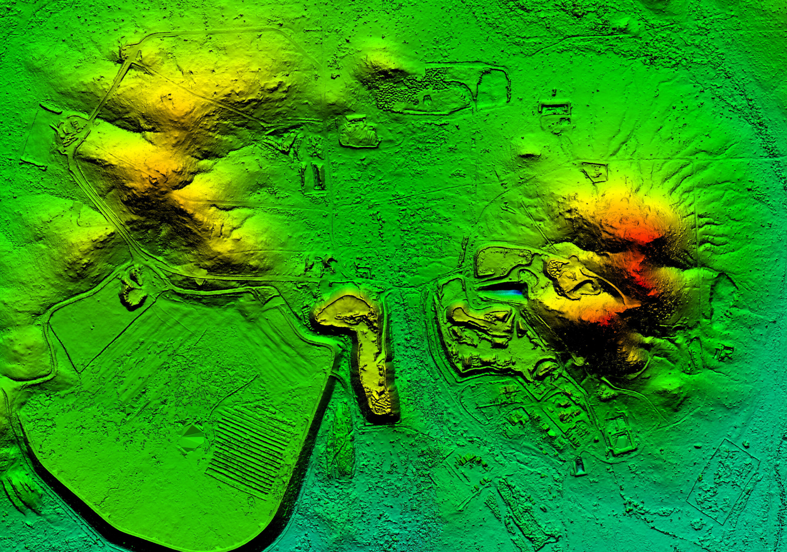
Elevation modelling
We produce high-precision digital surface, terrain, and canopy height models (DSM, DTM, CHM) from LiDAR and photogrammetric data sources.

LiDAR point cloud processing
We classify and analyse LiDAR point clouds to extract detailed information on vegetation structure, ground topography and built features.
Time series data processing
We acquire and process multi-temporal data to quantify changes in vegetation condition, temperature patterns, land use and landscape geomorphology.

Elevate your ecological insights with remote sensing
Harness our remote sensing expertise to acquire high-quality spatial data that enhances your environmental assessments and monitoring capabilities. Enquire now to start the process.
Discover how we transform remote data into ecological intelligence


Submit an online enquiry