Roy Hill Rail Rehabilitation Monitoring
Challenge
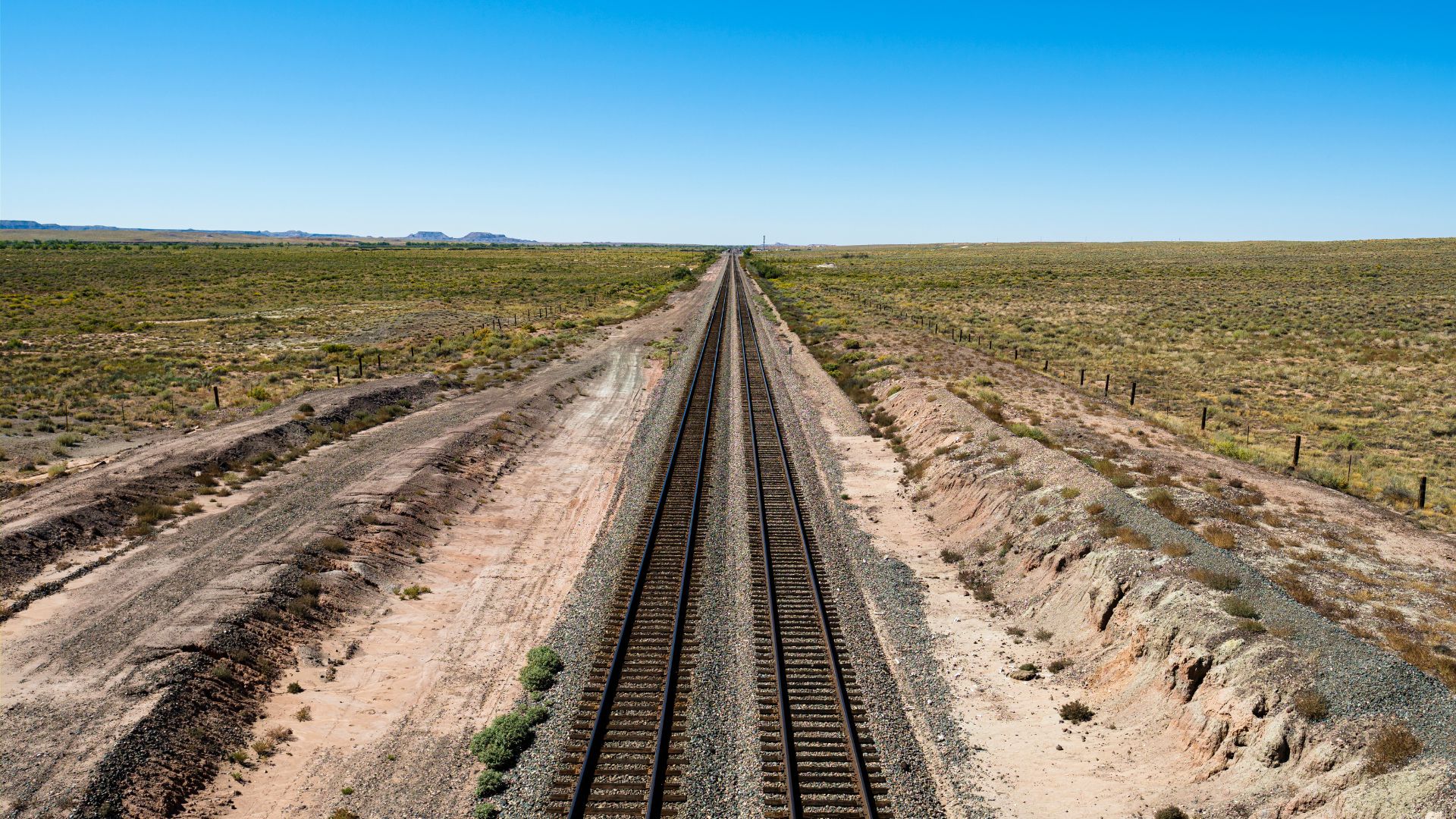
Roy Hill iron ore mine operations in the Pilbara region of Western Australia includes a rail corridor extending approximately 344 km to the coast at Port Hedland. Construction of the rail between YEAR and YEAR necessitated some disturbance of adjacent areas in the form of borrow pits, laydowns, spoil dumps and other features. As part of the Environmental Protection Authority approval of the railway, Roy Hill is required to monitor these disturbed areas and report their rehabilitation progress to the regulator.
In 2011 an on-ground transect-based rehabilitation and weed monitoring program was implemented for the rail, comprising 89 sampling transects. However, due to the practical challenges of field campaigns across an extensive remote area, not all rehabilitation areas contain transects. In addition, the transects may not be representative of the entire rehabilitation area. This makes it difficult to demonstrate to the regulator that rehabilitation progress complies with approval conditions.
Roy Hill sought a more comprehensive and cost-effective solution that enabled them to annually monitor all their rehabilitation along the rail corridor. They also wanted to access all their data (field and remote sensing) and photos in one place and compare over time without having to sort through large, printed reports.
Solution
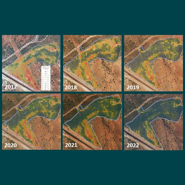
In 2016, Roy Hill engaged Ecoda to use remote sensing data analysis to assess vegetation within rehabilitation areas along the rail corridor. The most cost-effective approach was to upgrade the existing annual aerial capture for rail operations to 4-band data of a resolution appropriate to produce Ecoda vegetation metrics. Ecoda worked with Roy Hill to determine the best workspace configuration for the project.
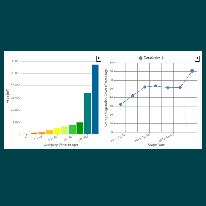
Vegetation cover and health metrics relevant to Roy Hill’s compliance requirements are produced across the entire data capture area, including all rehabilitation areas. This landscape approach ensures that a comprehensive sample of reference (analogue) data are available for comparison to rehabilitation areas. A custom metric relating to compliance criteria for rehabilitated vegetation to achieve 60% of the corresponding analogue vegetation cover is calculated and presented in Ecoda.
Outcome
The Roy Hill rehabilitation team now has access to several years of data and analytics over their entire rail corridor on Ecoda. Using the Ecoda visualisation and analysis tools Roy Hill can view the progress of rehabilitation over time as map overlays and graphs. They use this information to determine which areas have achieved completion criteria and can be included in their relinquishment requests to the regulator. They are also able to identify where additional management may be necessary to improve rehabilitation outcomes.
On-ground photos and monitoring data are also uploaded to monitoring points on Ecoda to provide more insights and for validation of remote sensing results.
In 2019 Roy Hill successfully relinquished 430 hectares of rehabilitated areas using supporting data from Ecoda. Many sites did not include on-ground transects and were relinquished solely based on the remote sensing data produced by Ecoda. Without Ecoda the process to produce appropriate data across all areas under application for relinquishment would likely have included costly additional field campaigns across limited areas, potentially resulting in fewer areas being approved for relinquishment and a requirement for ongoing works and monitoring.
Ecoda continues to undertake rail rehabilitation monitoring annually for Roy Hill.

Gain insight from above
Contact us to see how earth observation data can power your project